![]() World Wind is an open source virtual globe developed by NASA and the open source community for use on personal computers. WW works on Java platform, it is know as world wind java. World Wind Java is cross platform and provides a suite of demo apps.
World Wind is an open source virtual globe developed by NASA and the open source community for use on personal computers. WW works on Java platform, it is know as world wind java. World Wind Java is cross platform and provides a suite of demo apps.
The program overlays NASA and USGS satellite imagery, aerial photography, topographic maps and publicly available GIS data on 3D models of the Earth and other planets.
Apart from the Earth there are several worlds in World Wind all these worlds are available in the File menu. Users can interact with the selected planet by rotating it, tilting the view, and zooming in and out. Five million place names, political boundaries, latitude/longitude lines and other data can be displayed. World Wind includes support for .X (DirectX 3D polygon mesh) models and advanced visual effects such as atmospheric scattering or sun shading.
World Wind uses digital elevation model data collected by NASA’s Shuttle Radar Topography Mission. This means one can view topographic features such as the Grand Canyon or Mount Everest in three dimensions. WW has bathymetry data which allows users to see ocean features, such as trenches and ridges, in 3D.
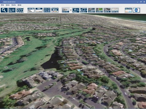
[advt]World Wind allows any user to zoom from satellite altitude into any place on Earth, leveraging high resolution LandSat imagery and SRTM elevation data to experience Earth in visually rich 3D, just as if they were really there.
Particular focus was put into the ease of usability so people of all ages can enjoy World Wind. All one needs to control World Wind is a two button mouse. Additional guides and features can be accessed though a simplified menu. Navigation is automated with single clicks of a mouse as well as the ability to type in any location and automatically zoom into it.

Be the first to comment